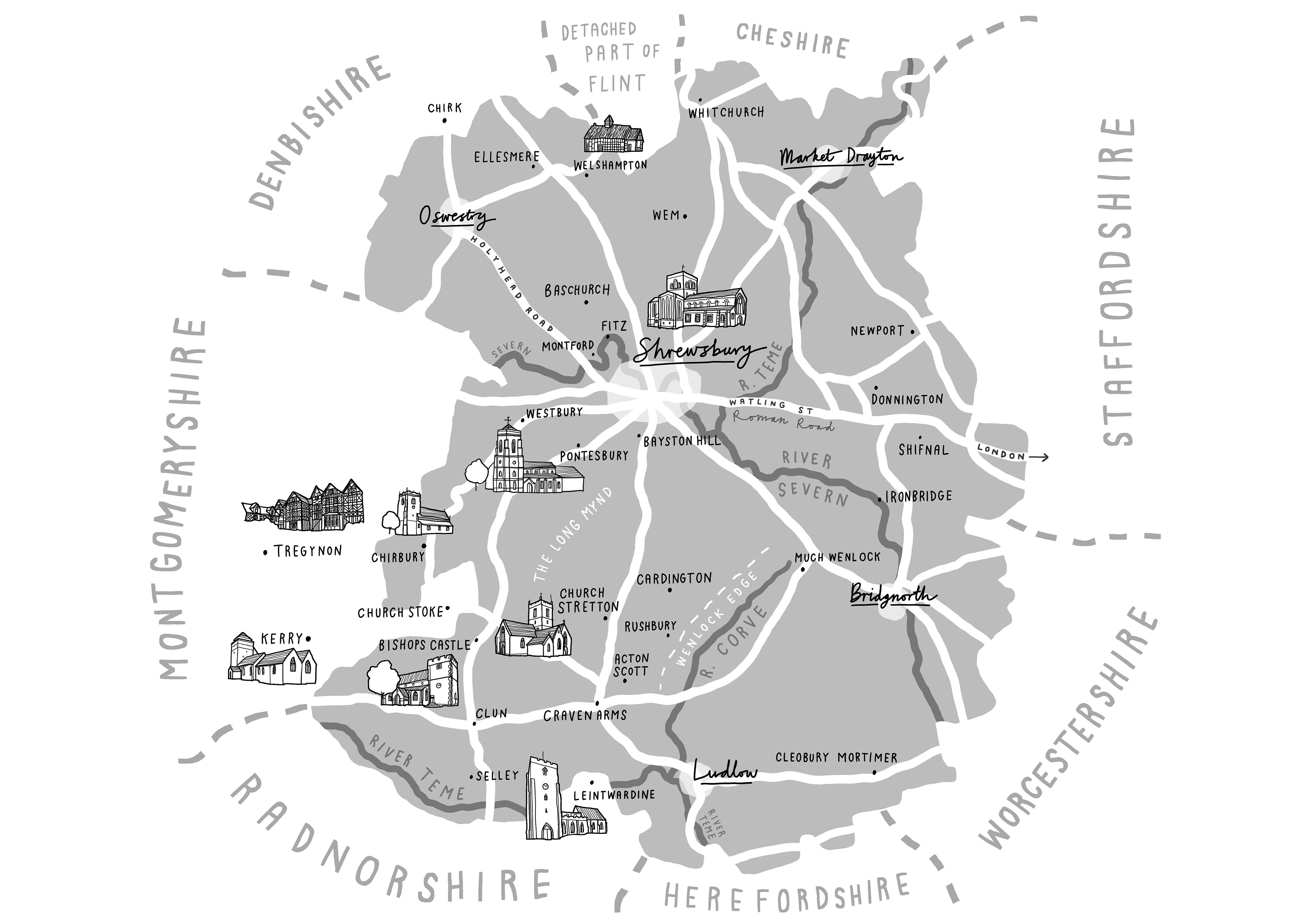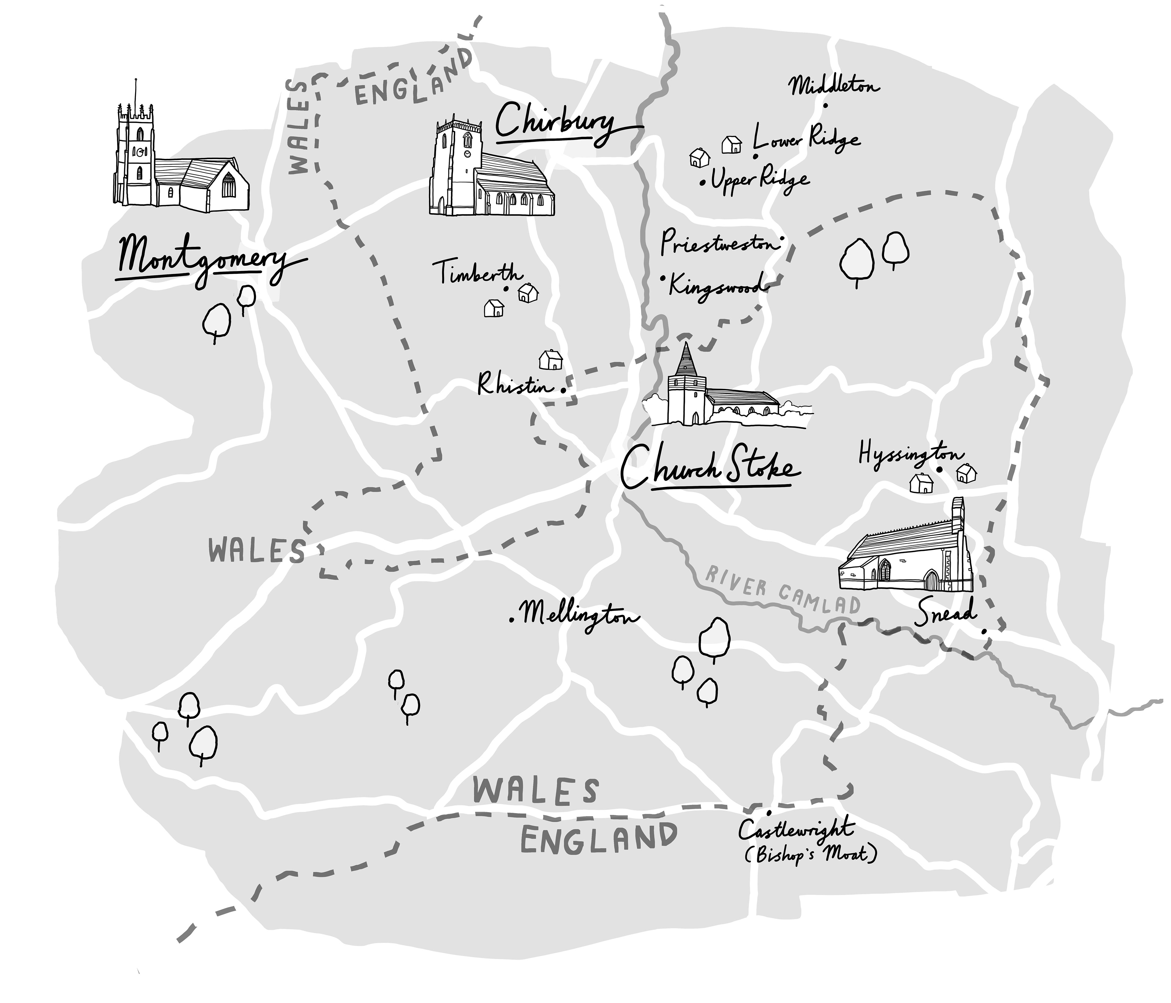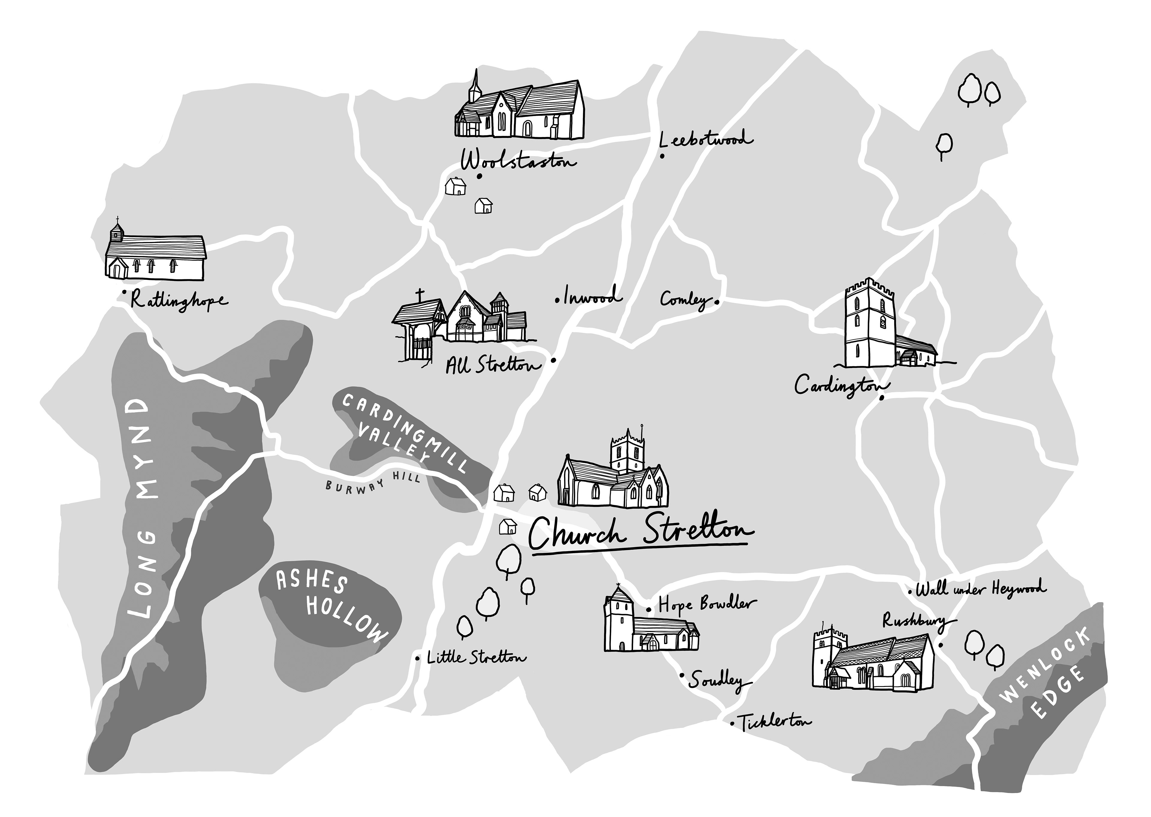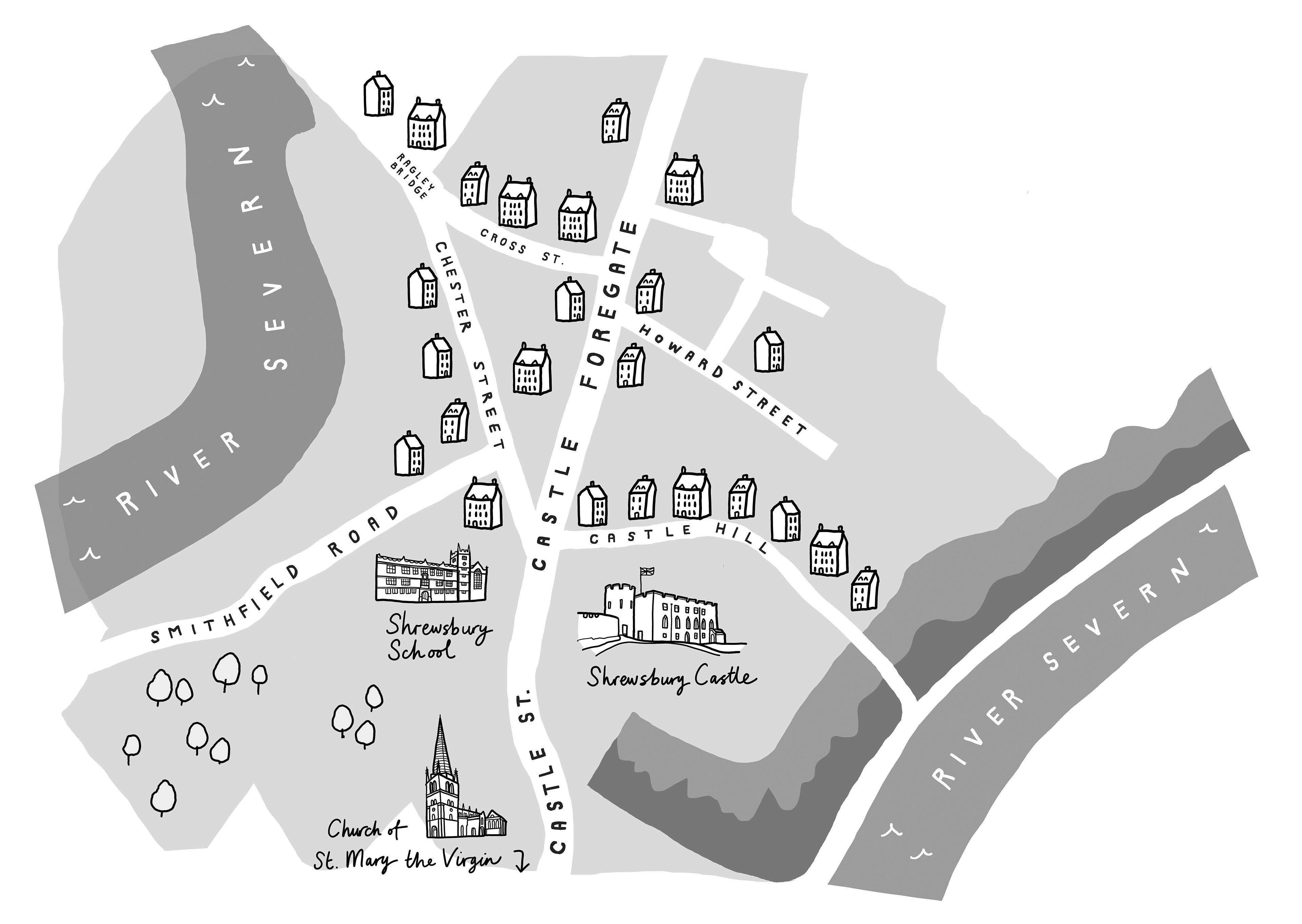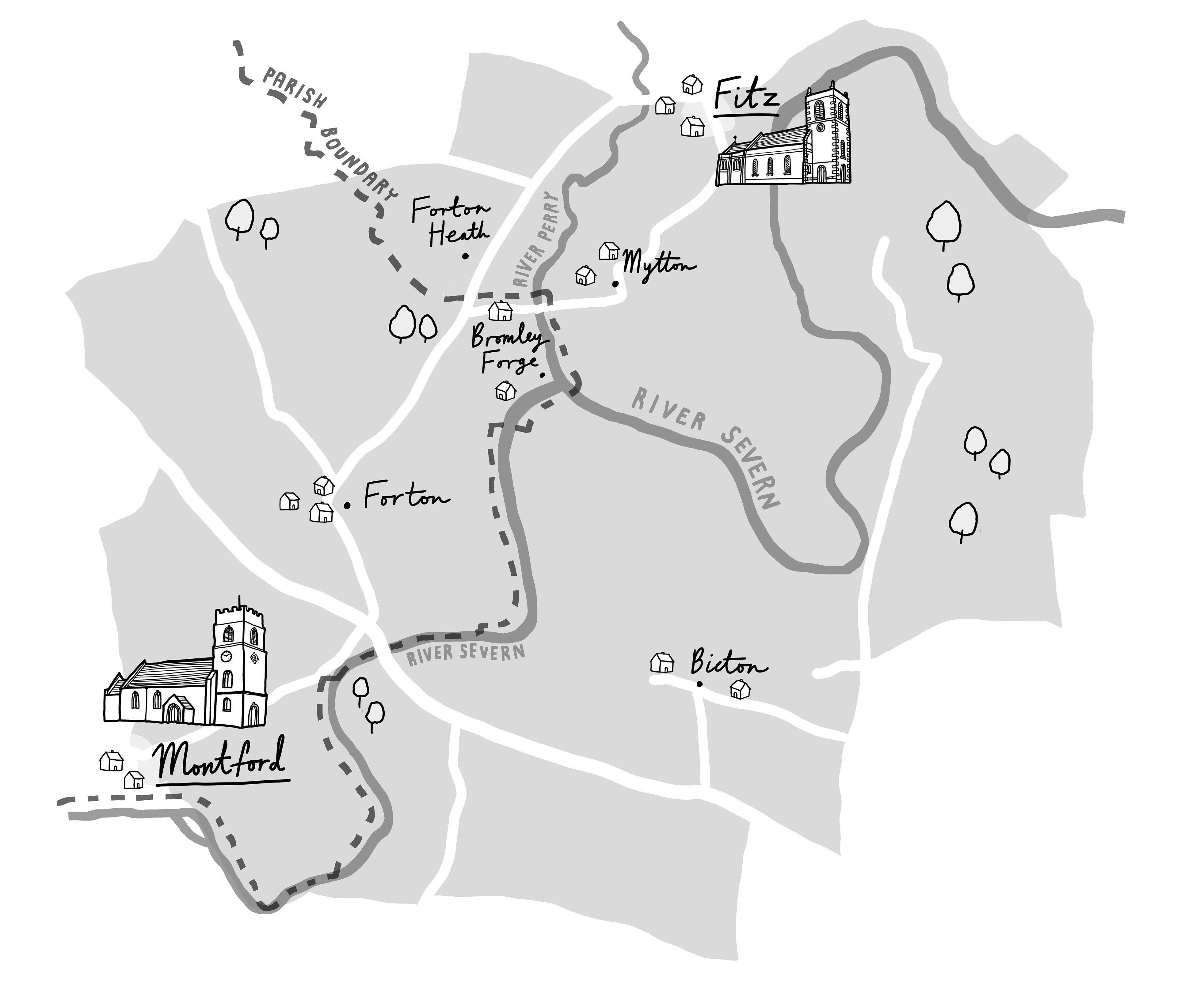
A selection of illustrated maps of Shropshire and various parish boundaries for a family history book by John Speake. The maps offered a unique challenge in that they were to be published in greyscale, so needed a variety of tone and detail without using colour.