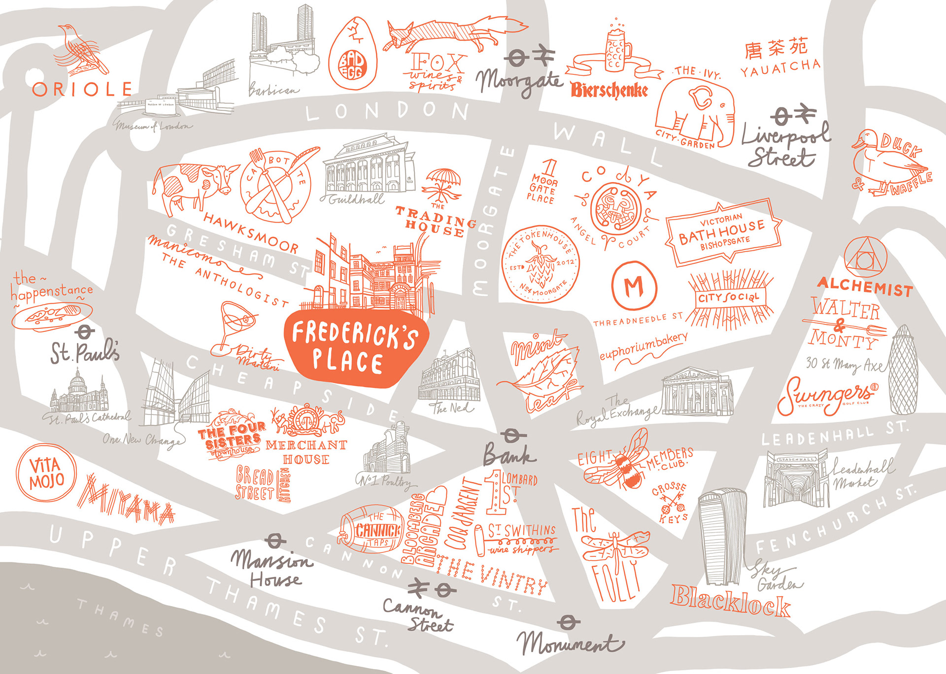
Frederick's Place and Old Jewry is an 18th century Georgian cul-de-sac in the City Of London that was redeveloped for office and restaurant space by John Robertson Architects (JRA). The illustrated map uses the logos of the surrounding restaurants and businesses to show what's on offer in the area, along with a basic map of the local streets.
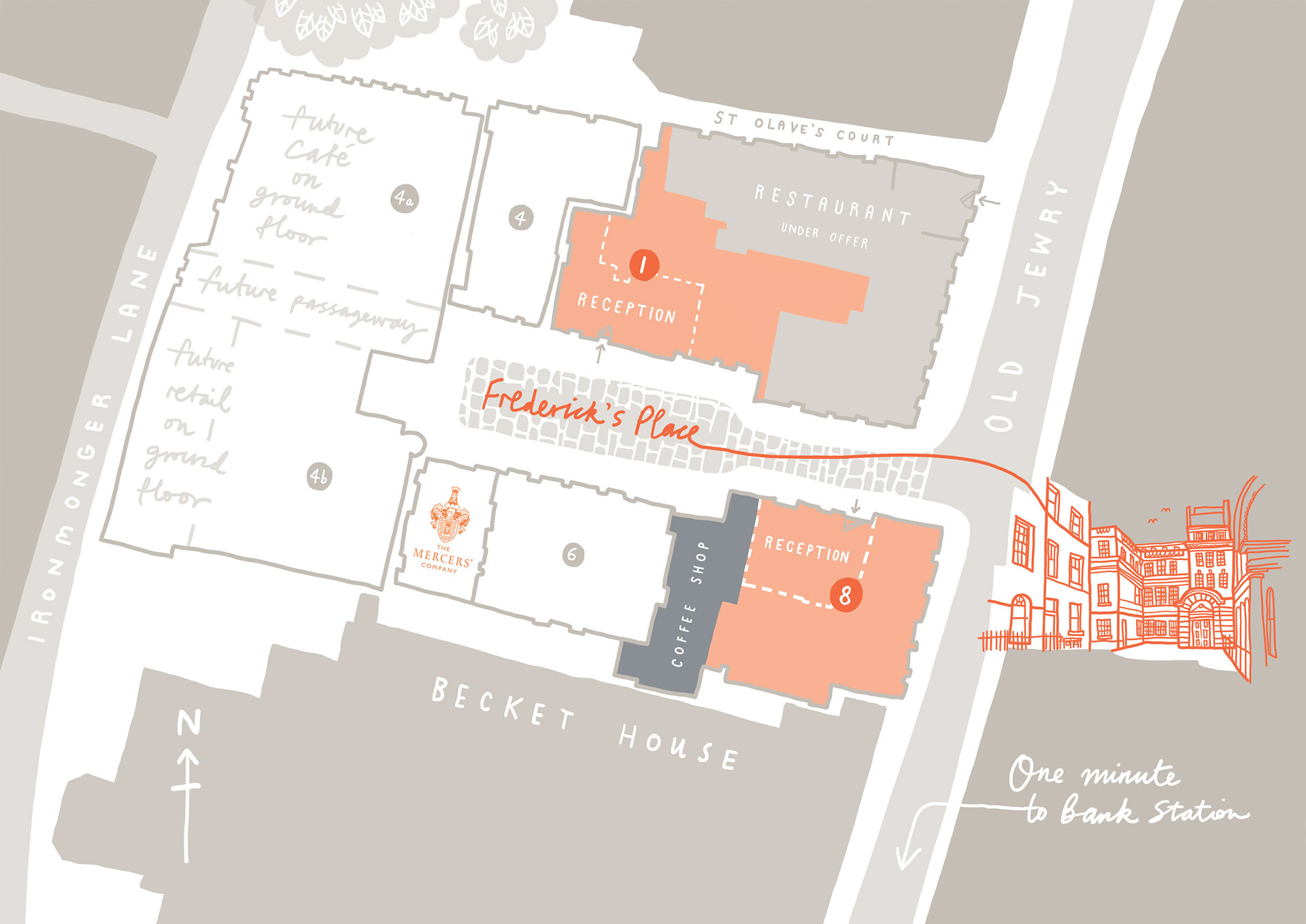
There's also a more accurate estate map and floorplan that goes into more detail about how the space will be used, whilst keeping that feel of a map illustration and the colours from the main map.
Art direction by Socrates.